Licensed • Insured • Locally Operated in Central Virginia

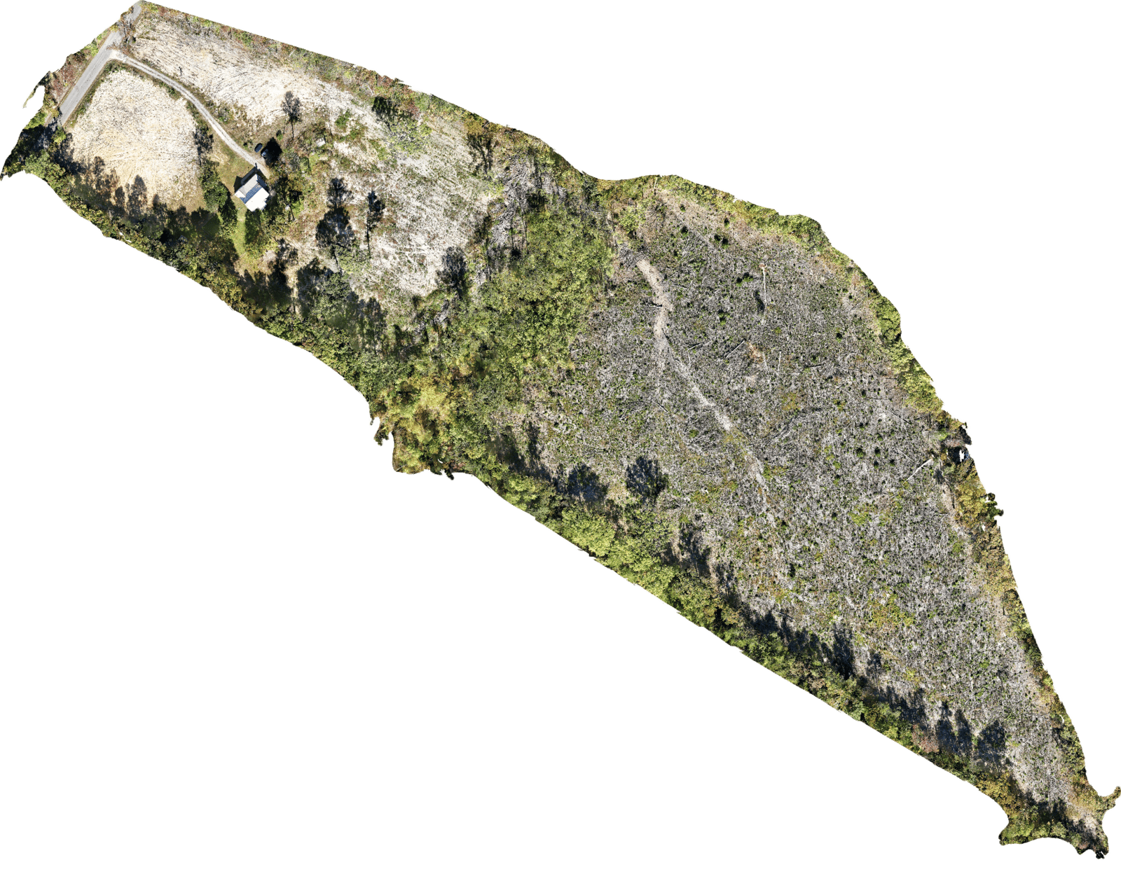
Aerial Mapping
Gain a complete perspective of your project site with TerraFuga Aerial’s precision 2D mapping services. Using high-resolution aerial imagery and advanced processing, we create detailed orthomosaic maps that support planning, documentation, and site analysis. Our mapping solutions deliver accurate, up-to-date visuals that empower clients to make informed decisions with confidence while reducing field time by up to75% compared to traditional methods
Residential Real Estate Photography
TerraFuga Aerial provides cinematic aerial imagerythat highlights property features, landscaping, and neighborhood appeal from a unique perspective. Our visuals increase online visibility and help listings stand out in competitive markets. According to national listing data, homes featuring aerial photography sell up to 32% faster and at 5–10% higher closing prices than those using ground-level photos alone—helping agents attract buyers and close deals efficiently.
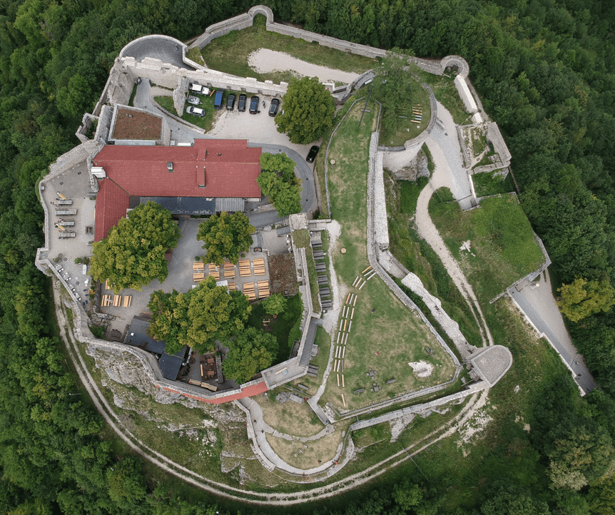
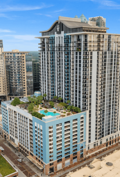
Commercial Real Estate Photography
TerraFuga Aerial enhances commercial real estate marketing and site assessment with high-resolution aerial photography and mapping. Our drone imagery captures properties from dynamic angles, showcasing layout, access points, and surrounding infrastructure in ways that drive investor confidence and accelerate decision-making. Businesses using professional aerial visuals report up to 68% faster property sales and 50% greater online engagement compared to listings without aerial content—delivering measurable value on every project.
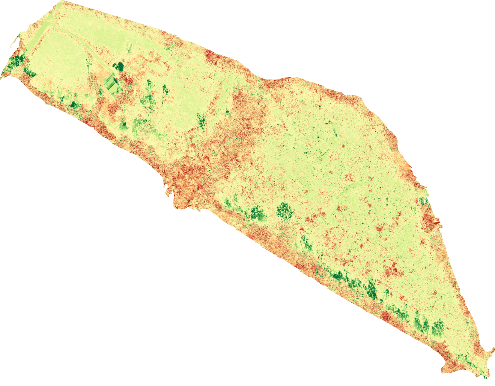
Agricultural Crop Analysis
TerraFuga Aerial’s crop analysis services utilize advanced drone imagery to evaluate plant health through variations in light reflectance, revealing detailed insights into crop growth, stress levels, and yield potential. By enabling targeted interventions and more informed management decisions, our aerial data can help producers achieve up to 20% higher yields at harvest.

Infastructure Inspections
TerraFuga Aerial delivers safe, efficient, and cost-effective drone inspection services for infrastructure and utility assets. Our high-resolution aerial imaging captures detailed visuals of towers, bridges, solar arrays, and other critical structures—reducing downtime, minimizing safety risks, and eliminating costly manual inspections. With average cost savings of up to 40%, our clients gain faster insights and greater operational efficiency. Every TerraFuga mission provides accurate, actionable data to support maintenance planning, regulatory compliance, and long-term asset management.
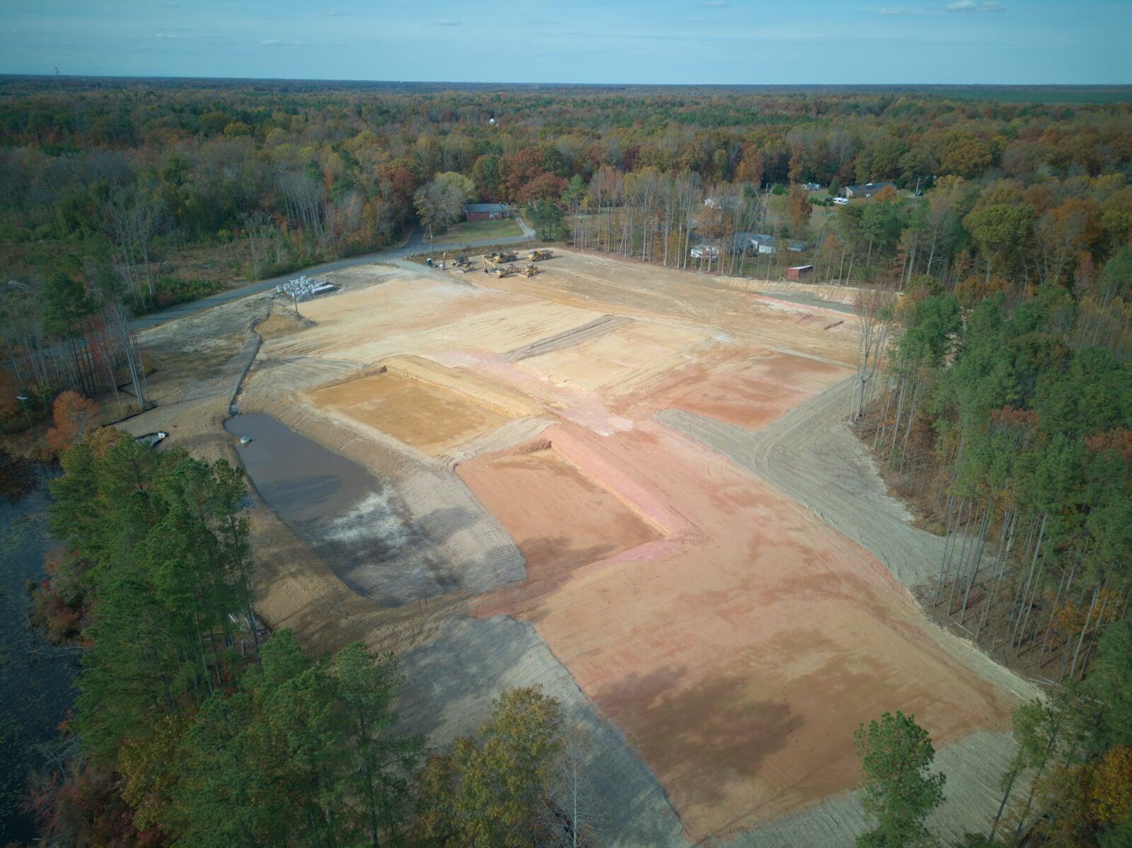
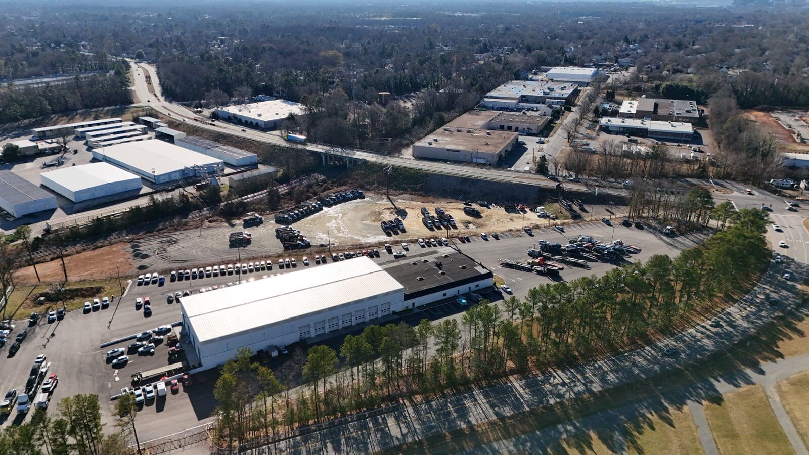
Construction Progress Monitoring
Track every stage of your project with TerraFuga Aerial’s construction progress monitoring services. We capture consistent, high-quality aerial imagery and 2D site maps to document development, verify contractor performance, and support stakeholder reporting. Our drone-based monitoring can reduce site visit time by up to 60% while improving communication, transparency, and stakeholder confidence.
Our world-class Aerial and Mapping Solutions
Our world-class Aerial and Mapping Solutions are guaranteed to enhance efficiency, improve accuracy, and provide actionable insights for every project. Whether you need stunning aerial visuals to market a property or precise geospatial data for site planning, TerraFuga delivers results you can trust. We combine cutting-edge drone technology with expert data processing to ensure every flight produces measurable value. At TerraFuga, we don’t just capture images—we empower your vision from above.

Pilot Education community
Here, we've a supportive community where like-minded individuals inspire and empower each other on their journey into the sky
Dedicated and professional Pilots
At Terrafuga Aerial, our pilots are more than just operators—they’re highly trained professionals passionate about precision, safety, and excellence. Every mission is flown by FAA Part 107–certified pilots who bring a meticulous approach to planning, execution, and data integrity. From complex mapping projects to dynamic aerial shoots, our team is committed to delivering results that exceed expectations while maintaining the highest standards of compliance and professionalism.
With a passion for precision and an eye for detail, TerraFuga Aerial brings cutting-edge drone technology to real estate, construction, agriculture, and infrastructure projects. Whether you need aerial imagery for marketing, site documentation, or technical mapping, our team delivers reliable data and visuals—on time and on budget.