
Aerial Services

Our world-class aerial mapping and imaging solutions help clients save time, reduce costs, and make informed decisions using precise geospatial data. Whether you need detailed topography, 3D site models, or dynamic marketing visuals, TerraFuga Aerial delivers measurable results—on schedule, every time.
Aerial Photo of timber cleared land

Aerial Mapping

Gain a complete perspective of your project site with TerraFuga Aerial’s precision 2D mapping services. Using high-resolution aerial imagery and advanced processing, we create detailed orthomosaic maps that support planning, documentation, and site analysis. Our mapping solutions deliver accurate, up-to-date visuals that empower clients to make informed decisions with confidence while reducing field time by up to 75% compared to traditional methods

Commercial Real Estate Photography

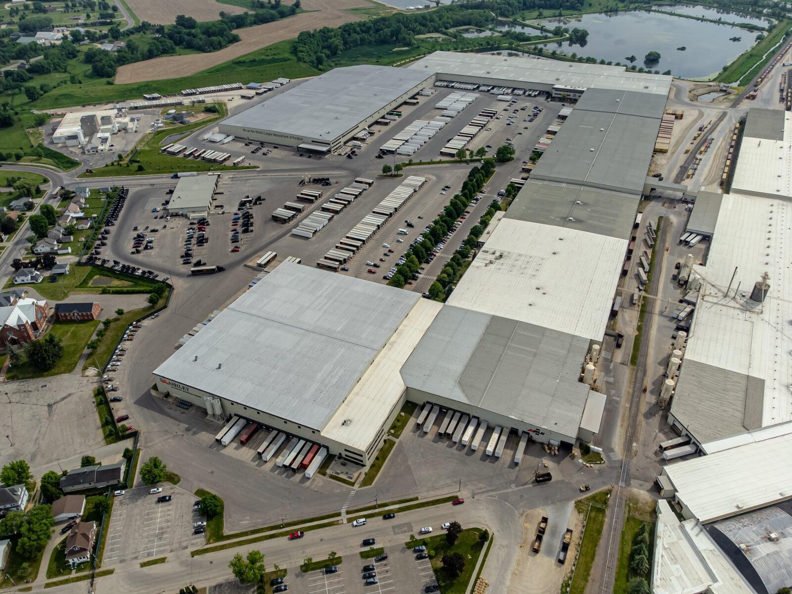
TerraFuga Aerial enhances commercial real estate marketing and site assessment with high-resolution aerial photography and mapping. Our drone imagery captures properties from dynamic angles, showcasing layout, access points, and surrounding infrastructure in ways that drive investor confidence and accelerate decision-making. Businesses using professional aerial visuals report up to 68% faster property sales and 50% greater online engagement compared to listings without aerial content—delivering measurable value on every project.

Overhead photo of commercial real estate warehouse
NDVI crop anaysis map

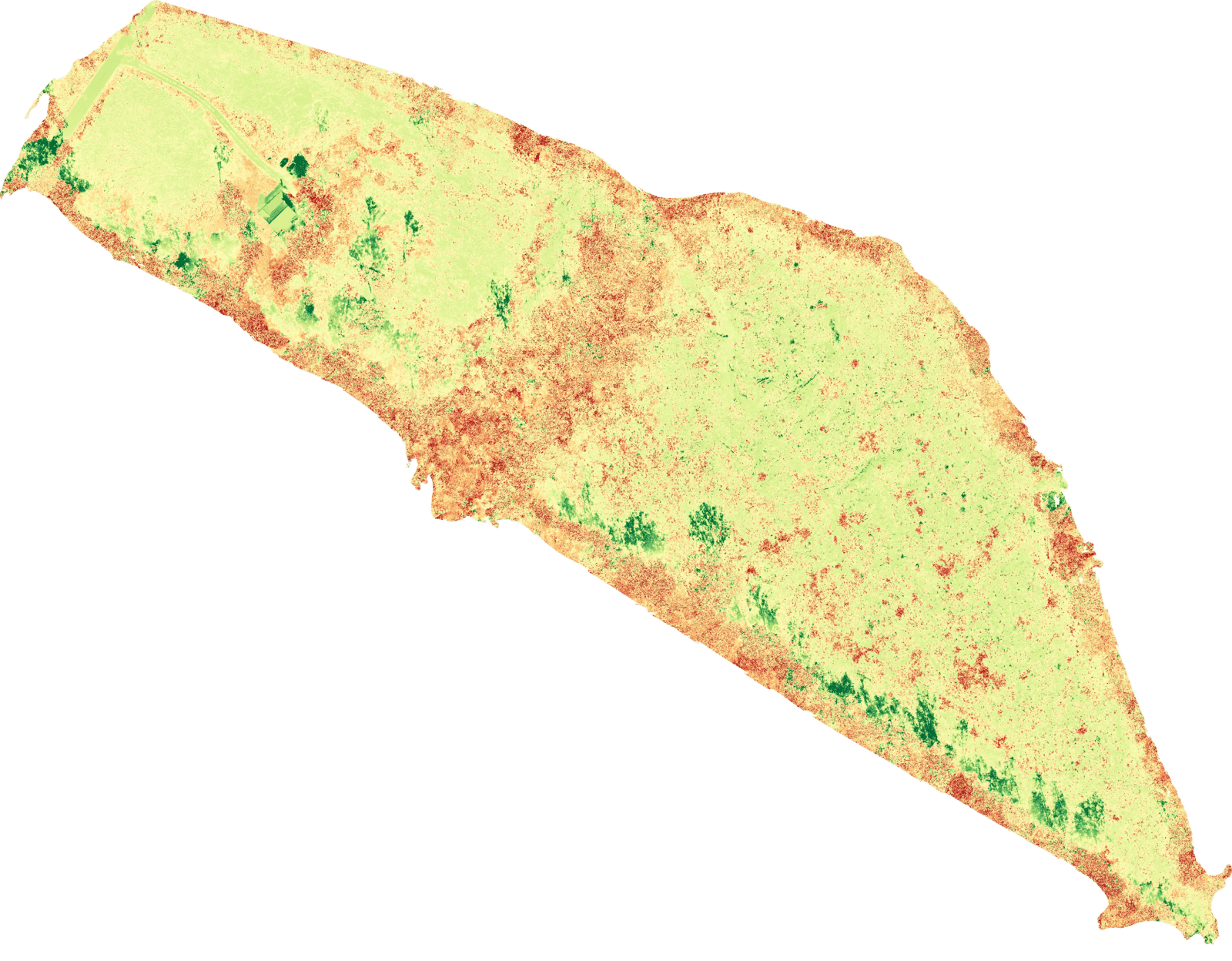
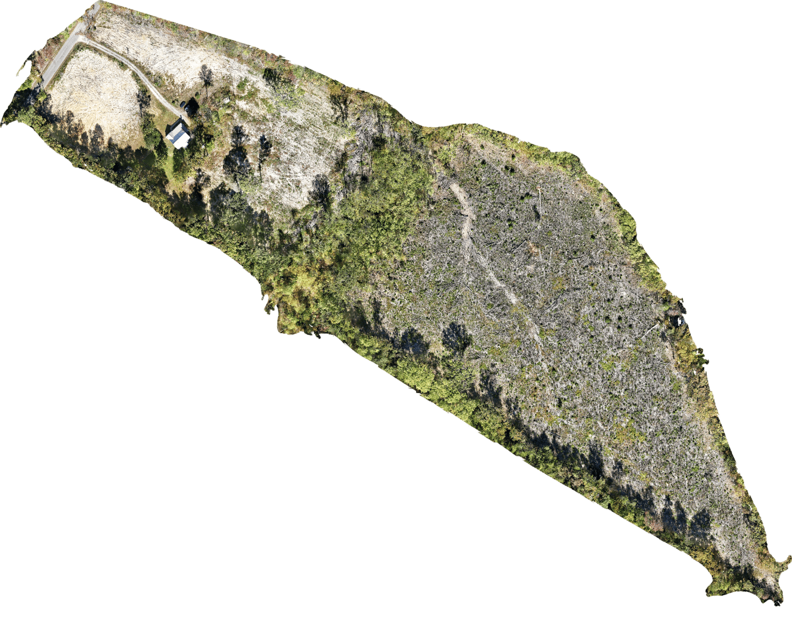
Crop Health Analysis

TerraFuga Aerial’s crop analysis services utilize advanced drone imagery to evaluate plant health through variations in light reflectance, revealing detailed insights into crop growth, stress levels, and yield potential. By enabling targeted interventions and more informed management decisions, our aerial data can help producers achieve up to 20% higher yields at harvest.

Residential Real Estate Photography

For residential listings, TerraFuga Aerial provides cinematic aerial imagery that highlights property features, landscaping, and neighborhood appeal from a unique perspective. Our visuals increase online visibility and help listings stand out in competitive markets. According to national listing data, homes featuring aerial photography sell up to 32% faster and at 5–10% higher closing prices than those using ground-level photos alone—helping agents attract buyers and close deals efficiently.

Overhead photo of residentail real estate on top of a hill
Overhead photo of construciton site

Infrastructure Inspections

TerraFuga Aerial delivers safe, efficient, and cost-effective drone inspection services for infrastructure and utility assets. Our high-resolution aerial imaging captures detailed visuals of towers, bridges, solar arrays, and other critical structures—reducing downtime, minimizing safety risks, and eliminating costly manual inspections. With average cost savings of up to 40%, our clients gain faster insights and greater operational efficiency. Every TerraFuga mission provides accurate, actionable data to support maintenance planning, regulatory compliance, and long-term asset management.

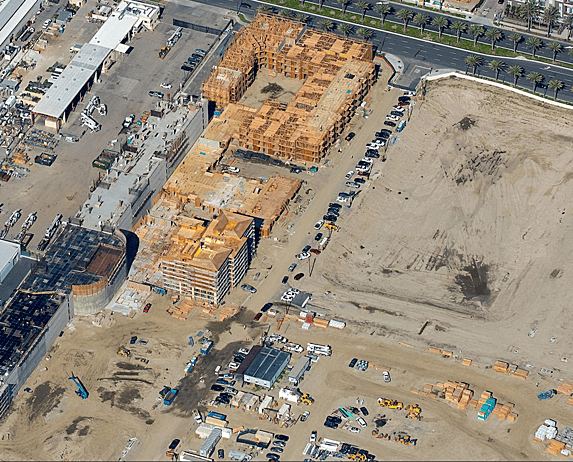
Construction Site Monitoring

Track every stage of your project with TerraFuga Aerial’s construction progress monitoring services. We capture consistent, high-quality aerial imagery and 2D site maps to document development, verify contractor performance, and support stakeholder reporting. Our drone-based monitoring can reduce site visit time by up to 60% while improving communication, transparency, and stakeholder confidence.
Bridge inspection Photo

Contact

Map

Ready to see your project from a higher perspective?
Contact TerraFuga Aerial today for professional drone mapping and imaging services across Central Virginia.